11 markeasy
(d)
Study Figure 1b in the Resource Booklet.
Identify the feature of the storm hydrograph labelled X.
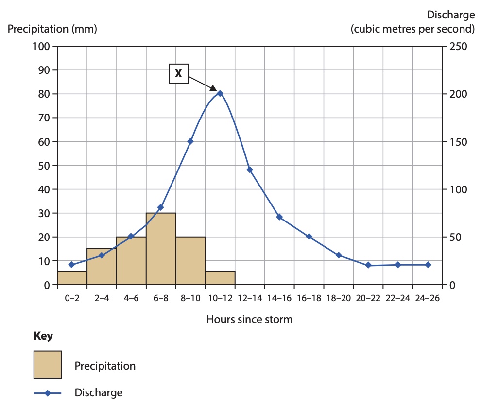
Figure 1b
18 questions · 63 marks · ≈ 63 min · spans 18 of 39 topics
Assembled from the topic question banks — not an official Edexcel paperStudy Figure 1b in the Resource Booklet.
Identify the feature of the storm hydrograph labelled X.
Figure 1b
State one physical factor that influences the rate of erosion in a river
Explain how the process of hydraulic action erodes the river channel
Study Figure 1a below
Explain one advantage and one disadvantage of the flood prevention methods shown
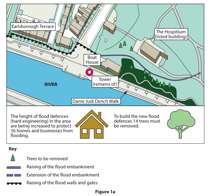
Explain one flood prevention method
Study Figure 2a in the Resource Booklet.
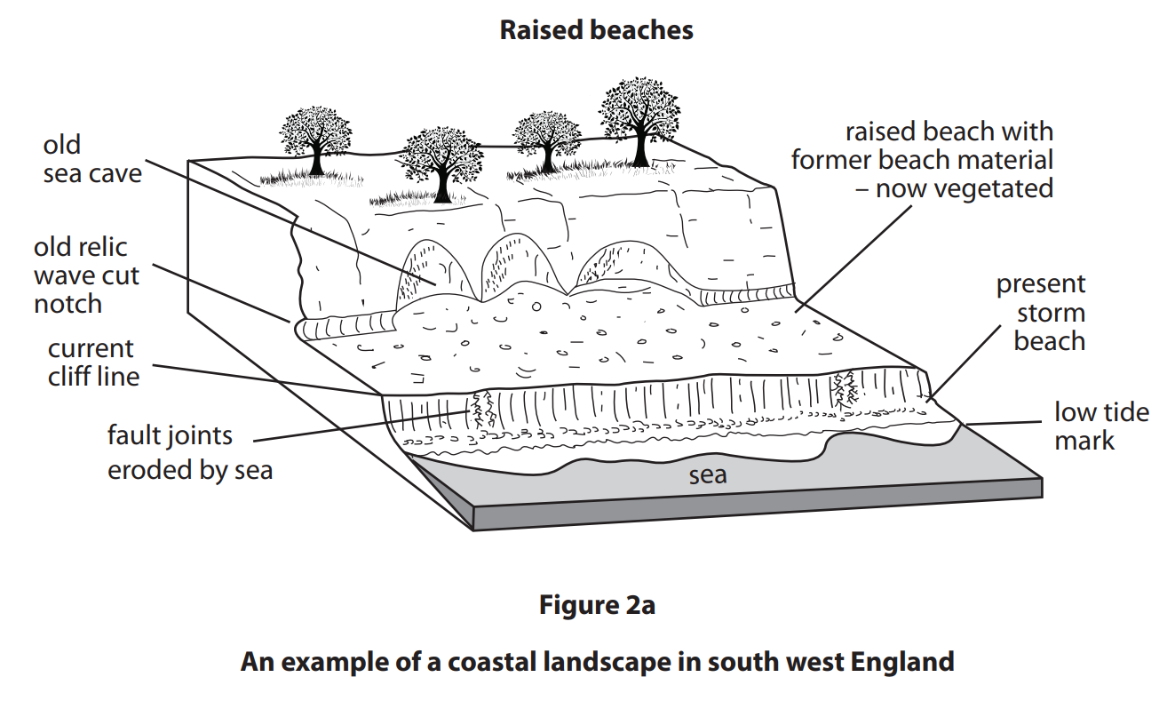
Suggest two ways changes in sea level have created coastal landforms.
Coastal environments
Study Figure 2 which shows a stretch of tropical coastline.
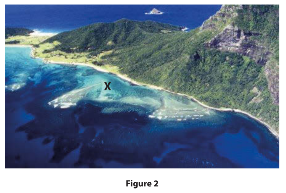
Identify the coastal ecosystem at X.
Choose your answer
coral reef
mangrove
salt marsh
sand dune
Compare hard engineering and soft engineering methods used to manage coastal flooding.
Identify the natural hazard.
Choose your answer
car emission pollution
nuclear meltdown
oil slick from a ship
volcanic eruption
Study Figure 3a.
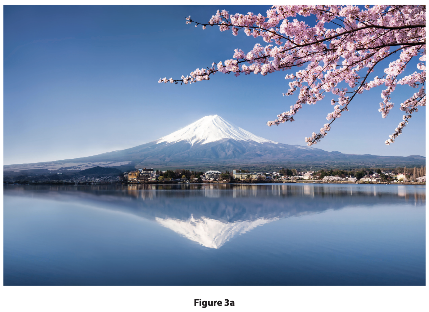
Suggest two physical characteristics that make this volcanic region vulnerable.
You must refer to the resource in you
Explain one way hazard mapping can help preparation for an earthquake event
The Clark Fisher model is used to describe the process of industrialisation. Identify the stage which is characterised by agriculture being the most important sector.
Choose your answer
pre-industrial phase
industrial phase
development pathway phase
post-industrial phase
Define the term employment structure.
Identify the economic sector that includes manufacturing as an activity.
Choose your answer
quaternary
tertiary
secondary
primary
State two characteristics of informal employment in a named megacity.
Identify one way to make transport more sustainable.
Choose your answer
increasing the use of powerful petrol engines
increasing air travel routes.
increasing the use of electric battery technology
increasing the size of motorways.
Identify one of the goods provided by natural ecosystems.
Choose your answer
soil formation
waste decomposition
timber
gas exchange
Study Figure 2a below.
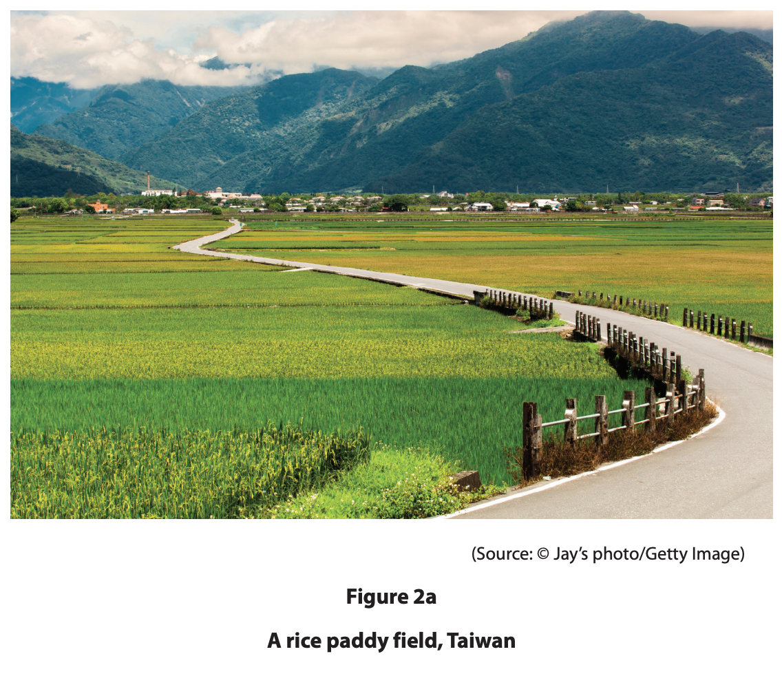
Explain one physical factor that could have influenced the choice of crop shown in the farming system on Figure 2a.
Study Figure 5 which shows the location of Fair Isle and gives some information about the island.
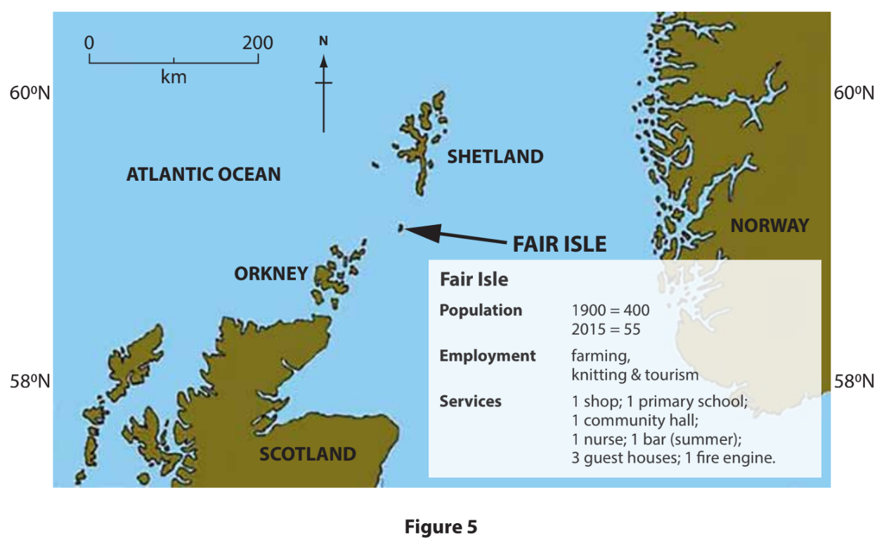
What is the distance between Fair Isle and the southern tip of Shetland?
Choose your answer
20 km
40 km
60 km
80 km
State the evidence for the depopulation of Fair Isle since 1900.
Suggest two factors that might have encouraged the depopulation of this island.
For a named developing or emerging country, explain two ways farm incomes are being diversified.
Analyse the reasons why an increasing proportion of the world's population is living in urban areas.
What is meant by the term shanty town?
Analyse the possible reasons for changes on the rural–urban fringe of a named developed city.